Property Record
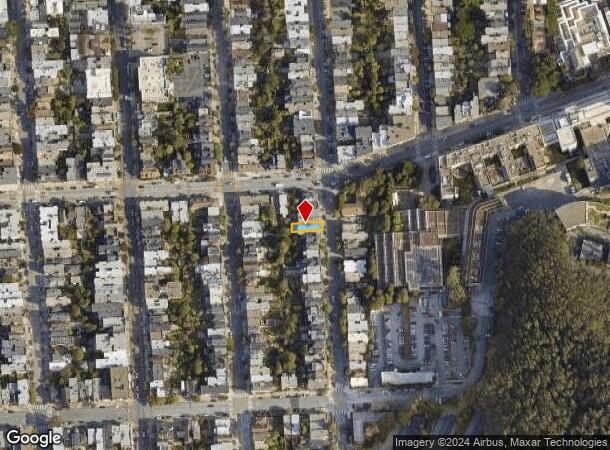
1415 5Th Ave, San Francisco, CA 94122


NEARBY LISTINGS FOR SALE OR LEASE
Property Detail
1415 5Th Ave
San Francisco
Outside Land Bl #764
San Francisco-San Mateo-Redwood City, CA
BLK 764
1848-004
San Francisco
Apartment
California
2024
4
2025
0.06 AC
030102
Inner Sunset
3,516 SF
DEMOGRAPHICS near 1415 5Th Ave
1 mile
3 mile
5 mile
2024 Total Population
47,501
473,426
835,758
2029 Population
44,019
438,005
773,397
Pop Growth 2024-2029
(7.33%)
(7.48%)
(7.46%)
Average Age
42
43
42
2024 Total Households
20,112
203,121
349,709
HH Growth 2024-2029
(7.89%)
(7.91%)
(7.80%)
Median Household Inc
$152,544
$137,868
$124,632
Avg Household Size
2.30
2.20
2.20
2024 Avg HH Vehicles
1.00
1.00
1.00
Median Home Value
$1,123,940
$1,113,556
$1,095,719
Median Year Built
1947
1948
1949
Nearby Places
Map Layers
Map Styles
 Street
 Aerial
Transit
 Traffic
 Biking
Places
Listings with unknown addresses are not visible on the map
- Restaurants
- Banks
- Shops
- Fitness
- Groceries
PUBLIC TRANSPORTATION
TRANSIT/SUBWAY
Irving and 4th Avenue (N Judah - San Francisco Municipal Railway (MUNI Metro))
Drive
Walk
Distance
Irving and 4th Avenue (N Judah - San Francisco Municipal Railway (MUNI Metro))
1 min
4 min
0.2 mi
Irving St & 7th Ave (N Judah - San Francisco Municipal Railway (MUNI Metro))
Drive
Walk
Distance
Irving St & 7th Ave (N Judah - San Francisco Municipal Railway (MUNI Metro))
1 min
5 min
0.3 mi
Judah and 9th Avenue (N Judah - San Francisco Municipal Railway (MUNI Metro))
Drive
Walk
Distance
Judah and 9th Avenue (N Judah - San Francisco Municipal Railway (MUNI Metro))
1 min
7 min
0.3 mi
UCSF (N Judah - San Francisco Municipal Railway (MUNI Metro))
Drive
Walk
Distance
UCSF (N Judah - San Francisco Municipal Railway (MUNI Metro))
1 min
6 min
0.3 mi
COMMUTER RAIL
San Francisco 4th & King (Caltrain - Caltrain (Caltrain))
Drive
Walk
Distance
San Francisco 4th & King (Caltrain - Caltrain (Caltrain))
11 min
4.5 mi
Drive
Walk
Distance
11 min
4.6 mi
AIRPORT
San Francisco International
Drive
Walk
Distance
San Francisco International
25 min
14.5 mi
Metro Oakland International
Drive
Walk
Distance
Metro Oakland International
38 min
23.5 mi
Norman Y Mineta San Jose International
Drive
Walk
Distance
Norman Y Mineta San Jose International
61 min
46.6 mi
Nearby Properties
Address
Land Use
TOTAL SIZE
Lot Size
Zoning
Address
Land Use
TOTAL SIZE
Lot Size
Zoning
1,015,000 SF
2.43 AC
RC4
Address
Land Use
TOTAL SIZE
Lot Size
Zoning
248,303 SF
4.35 AC
Address
Land Use
TOTAL SIZE
Lot Size
Zoning
1.52 AC
C3G
Address
Land Use
TOTAL SIZE
Lot Size
Zoning
393,918 SF
3.36 AC
WMUG
Address
Land Use
TOTAL SIZE
Lot Size
Zoning
24.37 AC
Address
Land Use
TOTAL SIZE
Lot Size
Zoning
2.93 AC
Address
Land Use
TOTAL SIZE
Lot Size
Zoning
342,727 SF
1.36 AC
C3G
Address
Land Use
TOTAL SIZE
Lot Size
Zoning
411,904 SF
21.74 AC
C2
Address
Land Use
TOTAL SIZE
Lot Size
Zoning
291,522 SF
6.66 AC
CM
Address
Land Use
TOTAL SIZE
Lot Size
Zoning
718 SF
18.55 AC
RH2
Address
Land Use
TOTAL SIZE
Lot Size
Zoning
246,069 SF
0.69 AC
Address
Land Use
TOTAL SIZE
Lot Size
Zoning
89,551 SF
0.73 AC
RC4
Address
Land Use
TOTAL SIZE
Lot Size
Zoning
332,221 SF
1.17 AC
Address
Land Use
TOTAL SIZE
Lot Size
Zoning
450,000 SF
1.07 AC
C3G
Address
Land Use
TOTAL SIZE
Lot Size
Zoning
337,664 SF
0.36 AC
C3G
Address
Land Use
TOTAL SIZE
Lot Size
Zoning
346,710 SF
7.45 AC
RH2
Address
Land Use
TOTAL SIZE
Lot Size
Zoning
213,553 SF
0.46 AC
C3G
Address
Land Use
TOTAL SIZE
Lot Size
Zoning
409,895 SF
7.20 AC
RH3
Address
Land Use
TOTAL SIZE
Lot Size
Zoning
741,667 SF
1.96 AC
C3G
Address
Land Use
TOTAL SIZE
Lot Size
Zoning
241,907 SF
0.82 AC
C3G
Address
Land Use
TOTAL SIZE
Lot Size
Zoning
524,271 SF
1.06 AC
RC4
Address
Land Use
TOTAL SIZE
Lot Size
Zoning
2.40 AC
NC3
Address
Land Use
TOTAL SIZE
Lot Size
Zoning
1,320,000 SF
3.01 AC
C3G
Address
Land Use
TOTAL SIZE
Lot Size
Zoning
250,843 SF
6.62 AC
NC3
Address
Land Use
TOTAL SIZE
Lot Size
Zoning
151,084 SF
1.35 AC
Address
Land Use
TOTAL SIZE
Lot Size
Zoning
231,687 SF
8.64 AC
Address
Land Use
TOTAL SIZE
Lot Size
Zoning
Address
Land Use
TOTAL SIZE
Lot Size
Zoning
3 AC
C3G
Address
Land Use
TOTAL SIZE
Lot Size
Zoning
225,851 SF
1.19 AC
NCT1
Address
Land Use
TOTAL SIZE
Lot Size
Zoning
199,678 SF
1.06 AC
UMU
The World's #1 Commercial Real Estate Marketplace
Connect with us
© 2026 CoStar Group
The information above has been obtained from sources believed reliable. While we do not doubt its accuracy we have not verified it and make no guarantee, warranty or representation about it. It is your responsibility to independently confirm its accuracy and completeness. Any projections, opinions, assumptions, or estimates used are for example only and do not represent the current or future performance of the property. The value of this transaction to you depends on tax and other factors which should be evaluated by your tax, financial, and legal advisors. You and your advisors should conduct a careful, independent investigation of the property to determine to your satisfaction the suitability of the property for your needs.